
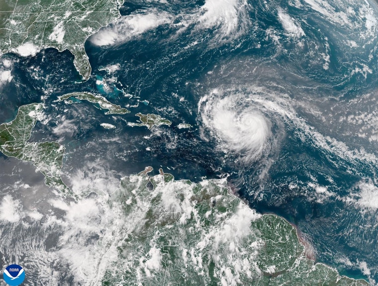
Hurricane Erin rapidly exploded overnight from a Category 3 storm to a massive Category 5 and is expected to strengthen further as it curves north between the U.S. East Coast and Bermuda this upcoming week, according to the National Hurricane Center.
The major hurricane was about 105 miles north of Anguilla on Saturday morning and heading west at 17 mph, with maximum sustained winds of 160 mph, the service’s hurricane center in Florida noted in an update at 11:20 a.m.
“On the forecast track, the center of Erin is expected to move just north of the northern Leeward Islands, the Virgin Islands, and Puerto Rico over the weekend,” the hurricane center said.
Erin is expected to slow down and shift west-northwest Saturday night, then turn north early next week as it passes north of the Leeward Islands, the Virgin Islands and Puerto Rico this weekend before curving between the U.S. East Coast and Bermuda. It will remain a major hurricane (Category 3 or higher) through midweek.
“Fluctuations in intensity are expected for the rest of the weekend,” the hurricane center said in an 11 a.m. update.
The storm is not currently forecast to hit land, but its strong winds are impacting nearby islands, prompting warnings of possible flooding and landslides.
There are tropical storm watches in effect for St. Martin and St. Barts, according to the hurricane center. The northern Leeward Islands, Virgin Islands, Puerto Rico, Turks and Caicos and the southeastern Bahamas should also keep an eye on the storm, the hurricane center advised.
In Sint Maarten, the Dutch half of St. Martin, there is also a flood advisory and a small aircraft advisory, according to the country’s government.
The Virgin Islands has a flood watch in effect through Monday evening, according to the Government House.
The storm is expected to bring heavy rainfall through Sunday to the northern Leeward Islands, Puerto Rico and the Virgin Islands. Rainfall totals of 2 to 6 inches are possible, the hurricane center said.
“Locally, considerable flash and urban flooding, along with landslides or mudslides, are possible,” the hurricane center said.
Erin will generate large, powerful waves that are forecast to affect Hispaniola, Turks and Caicos, the Virgin Islands, Puerto Rico and the northern Leeward Islands through the weekend, according to the hurricane center.
“These swells will spread to the Bahamas, Bermuda, and the east coast of the United States early next week,” the hurricane center said. “These rough ocean conditions will likely cause life-threatening surf and rip currents.”
Erin is the fifth named storm of the Atlantic hurricane season, which runs from June 1 to Nov. 30, but the first to reach hurricane status.
This year’s season is once again expected to be unusually busy. The forecast calls for six to 10 hurricanes, with three to five reaching major status with winds of more than 110 mph.
The U.S. government has deployed more than 200 employees from the Federal Emergency Management Agency and other agencies to Puerto Rico as a precaution as forecasters issued a flood watch for the entire U.S. territory from late Friday into Monday.
Puerto Rico Housing Secretary Ciary Pérez Peña said 367 shelters have been inspected and could be opened if needed.
Steve Strouss, Christine Rapp and The Associated Press contributed.